Sloth photo by Issana.tas via Wikimedia Commons.
Highlights
- Oropouche virus is expanding beyond the Amazon.
- Environmental modeling reveals widespread suitability.
- Deforestation and land-use change increase spillover risk.
- Biting midges drive transmission.
- Machine-learning models improve outbreak prediction.
- Millions already live in potential hotspots.
Vector-borne diseases like dengue, Zika, and malaria already threaten millions worldwide. Oropouche virus (OROV) now joins the list, spreading quietly (blog link) and often unnoticed.
Found mainly in Brazil and Peru, OROV has infected more than half a million people in Latin America. The true number is likely much higher.
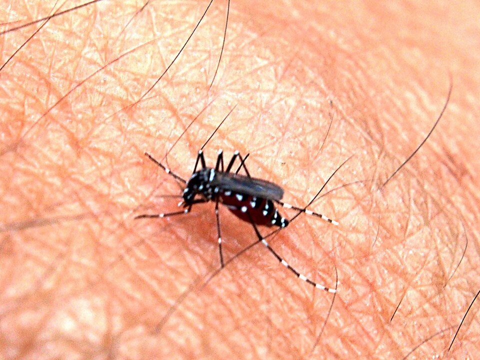
Biting midges, and possibly some mosquitoes, spread OROV. Infection causes fever, headaches, and body aches.
These symptoms closely resemble other tropical diseases, making OROV easy to miss. Climate change, deforestation, and human expansion into tropical forests increase the chances of spread.
In the research article by Romero-Alvarez et al. published in the open access BMC journal of Infectious Diseases of Poverty, researchers now used advanced mapping tools to predict where OROV may emerge next.
In this blog, we go over how they combined satellite imagery, case data, and landscape analysis to pinpoint high-risk areas for OROV infection. Their work shows how deforestation and habitat disruption increase human exposure.
Table of Contents
Methodology
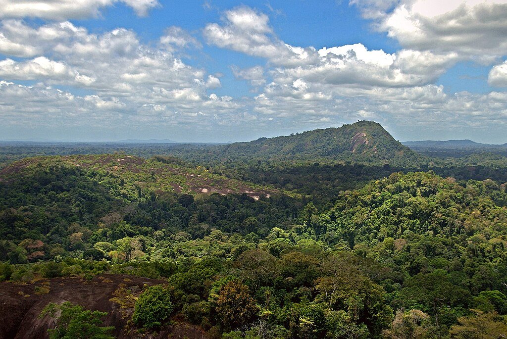
Amazon jungle from above. Photo by David Evers via Wikimedia Commons.
Because little is known about OROV circulation in wildlife, the study focused on confirmed human outbreaks as indicators of where the virus can persist.
Scientists compiled 35 laboratory-confirmed OROV outbreak records across South America from the early 2000s onward with 15 environmental predictors. They removed duplicate and spatially clustered records to avoid bias and improve model accuracy.
The team combined outbreak locations with environmental and satellite-derived data, including temperature, humidity, annual temperature range, and vegetation cover.
These variables allowed the models to identify environmental conditions that favor OROV transmission and to project where similar conditions exist across the region.
Machine learning models and environmental factors

Depiction of artificial intelligence. Photo by vpnsrus via Wikimedia Commons.
To estimate OROV’s potential geographic spread, researchers used two complementary modeling approaches: one-class support vector machines (OC-SVM), which identify environments that closely resemble known outbreak sites, and convex hull hypervolume modeling, which captures the full range of environmental conditions associated with OROV emergence.
Running the models multiple times across different calibration regions helped account for uncertainty and improve robustness.
Vegetation and land-use patterns played a key role in the analysis. Using high-resolution satellite-derived vegetation phenology, the researchers examined how vegetation structure and changes over time differed between outbreak locations and randomly selected sites.
This comparison revealed how deforestation and habitat disruption may increase human exposure to the virus.
Finally, the team overlaid population data onto the predicted risk maps to estimate how many people live in areas suitable for OROV transmission.
OROV Modelling Results
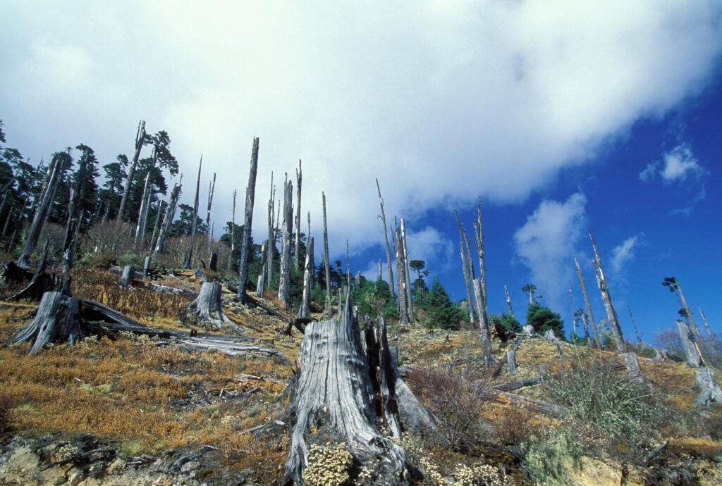
Deforestation. Photo by World Bank Photo Collection via Flickr.
Geographic Risk of OROV
The best-performing model covered the Americas and highlighted regions at risk.
Most tropical areas in South America were predicted to be suitable for OROV. Some Caribbean islands, such as Puerto Rico, the Dominican Republic, and Haiti, also showed potential risk.
In North America, parts of southwestern Mexico and coastal areas of California and Florida could be vulnerable.
Interestingly, regions like eastern Bolivia, Paraguay, and Uruguay have not reported OROV cases yet, but they fall within potential risk zones.
Human Populations at Risk
Finally, the researchers estimated the number of people living in areas suitable for OROV transmission.
Approximately 5 million people live in potential risk zones, with the highest-risk areas including coastal Ecuador, Colombia, Venezuela, Panama, central Mexico, Brazil, and eastern Bolivia.
These maps can guide public health officials in targeting surveillance, prevention, and early intervention efforts to reduce the impact of future outbreaks.
Role of Vegetation Loss
Vegetation loss emerged as an important factor influencing OROV transmission.
Areas experiencing deforestation or reduced plant cover were more likely to have virus activity.
This suggests that changes in land use can increase human contact with insects that carry OROV.
Regions showing significant vegetation loss included parts of Colombia, Ecuador, Peru, and eastern Bolivia, highlighting areas where monitoring and prevention efforts may be especially important.
Risk Patterns
Researchers compared two modeling approaches, OC-SVM and convex hulls, to predict where Oropouche virus (OROV) could spread in the Americas.
OC-SVM consistently performed better, producing clearer predictions for both environmental conditions favorable to OROV and the geographic areas at risk.
Convex hulls were more limited, but still provided useful information, especially when data were sparse.
Environmental factors like temperature, humidity, and rainfall played a key role in shaping these predictions.
Influence of Calibration Region and Predictors
The size of the area used to train the models influenced predictions.
Larger calibration regions sometimes resulted in smaller environmental spaces considered suitable for OROV, depending on the method and type of environmental data used.
These differences were more noticeable in the model’s environmental predictions than in its geographic maps.
By testing multiple approaches, researchers ensured the results were robust despite uncertainties in data and methodology.
Influence of Individual Outbreaks
The analysis revealed that specific outbreak locations can strongly shape risk predictions.
Two sites, one in northern Brazil and one in northern Argentina, stood out due to unique temperature and humidity conditions.
Excluding these locations from the model reduced predicted risk areas by more than 10%, showing that a few unusual outbreaks can have a significant impact on the overall map.
In conclusion
This study is one of the first to use advanced species distribution modeling and a “black box” approach for OROV.
By linking environmental patterns to human outbreaks, it provides a practical way to predict where the virus could spread next.
The results help public health officials plan preventive measures, target vector (e.g., midget, mosquito) control, and improve outbreak preparedness, especially in regions with limited surveillance.
Hypervolume modeling provides a valuable first step for mapping the ecological and geographic risk of Oropouche virus (OROV) transmission.
This study indicates that 2 to 5 million people across the Americas may live in areas at risk of OROV exposure.
Vegetation loss and environmental changes appear to increase the likelihood of future outbreaks, highlighting the link between deforestation, ecosystem disruption, and emerging infectious diseases.
The preliminary OROV risk map created offers a practical tool for public health planning, helping to identify high-risk regions and ecosystems for further research.
This includes studies on wildlife reservoirs, vector distribution, and the development of disease surveillance and prevention strategies.
As an emerging zoonotic disease with significant epidemic potential, Oropouche fever requires proactive monitoring to prevent its spread across Latin America and beyond.
Stay Informed, Stay Protected

Photo by Zuko.io Images via Wikimedia Commons.
Oropouche fever is an emerging threat across the Americas, with millions potentially at risk due to environmental changes and deforestation.
Learn how you can protect yourself and your community, stay updated on outbreak hotspots, and support research into wildlife reservoirs and vector control.